Star.pngStar.pngStar grey.pngStar grey.pngStar grey.png

A4170

From Roader's Digest: The SABRE Wiki
Jump to navigation Jump to search
A4170
A4170.jpg
Cameraicon.png View gallery (2)
From:  Coventry city centre (SP329794)
To:  Keresley (SP318821)
Distance:  1.8 miles (2.9 km)
Met:  A4053, B4107, B4098
Former Number(s):  A423
Now part of:  B4098
Primary Destinations
Traditional Counties

Warwickshire

Route outline (key)
A4170 Coventry - Keresley
The B4098 (former A4170) Radford Road

In 1973, the A423 between Coventry and the then-A47 at Over Whitacre was mostly downgraded to B4098, with the exception of the section from Coventry city centre to the edge of the urban area near Coundon and Keresley, which gained the A4170 number.

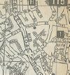
Starting on the A4053 inner ring road at what is now J9, the road headed northwestwards along Radford Road. After crossing the Coventry to Nuneaton railway line and meeting the B4107 the road became dual and continued through a couple of roundabouts before ending for no apparent reason at the junction with Keresley Green road; the road ahead was the B4098.

Sometime in the late 1980s, this anomalous section was downgraded to B4098, making a continuous number from Coventry city centre to Kingsbury.


A4170
Places
Related Pictures
View gallery (2)
A4170.jpgRadford Road, Coventry (C) Ian S - Geograph - 3796309.jpg
Other nearby roads
Coventry
A45 • A46 • A423 • A427 • A428 • A429 • A444 • A445 • A4023 • A4053 • A4082 • A4114 • A4273 • A4600 • B4027 (Warwickshire) • B4076 • B4082 (Coventry) • B4098 • B4101 • B4105 (Coventry) • B4106 • B4107 • B4107 (Coventry city centre) • B4108 • B4109 • B4110 • B4111 (Coventry - Kilworth) • B4113 • B4115 • B4118 (Coventry) • B4428 • B4454 (Coventry) • B4481 • B4544 • Coventry East-West Motorway • Coventry North-South Motorway • Droitwich - Leicester Motorway • E24 • E28 (Birmingham - Ipswich) • E33 (London - Glasgow) • E33 (Northampton - Liverpool) • Holyhead Road • M6 • M45 • M69 • Northern and Western Motorway • Sherbourne Valley Road • T11 (Britain) • T44 (Britain) • T114 (Britain)
A4100-A4199
A4100 • A4101 • A4102(W) • A4102(E) • A4103 • A4104 • A4105 • A4106 • A4107 • A4108 • A4109 • A4110 • A4111 • A4112 • A4113 • A4114 • A4115 • A4116 • A4117 • A4118 • A4119
A4120 • A4121 • A4122 • A4123 • A4124 • A4125 • A4126 • A4127 • A4128 • A4129 • A4130 • A4131 • A4132 • A4133 • A4134 • A4135 • A4136 • A4137 • A4138 • A4139
A4140 • A4141 • A4142 • A4143 • A4144 • A4145 • A4146 • A4147 • A4148 • A4149 • A4150 • A4151 • A4152 • A4153 • A4154 • A4155 • A4156 • A4157 • A4158 • A4159
A4160 • A4161 • A4162 • A4163 • A4164 • A4165 • A4166 • A4167 • A4168 • A4169 • A4170 • A4171 • A4172 • A4173 • A4174 • A4175 • A4176 • A4177 • A4178 • A4179
A4180 • A4181 • A4182 • A4183 • A4184 • A4185 • A4186 • A4187 • A4188 • A4189 • A4190 • A4191 • A4192 • A4193 • A4194 • A4195 • A4196 • A4197 • A4198 • A4199
Former iterations: A4105(W) • A4105(E) • A4108 • A4114 • A4115 • A4116 • A4125 • A4141 • A4150 • A4154 • A4160 • A4168

This page includes a scan of a non-free copyrighted map, and the copyright for it is most likely held by the company or person that produced the map. It is believed that the use of a limited number of web-resolution scans qualifies as fair use under United States copyright law, where this web page is hosted, as such display does not significantly impede the right of the copyright holder to sell the copyrighted material, is not being used to generate profit in this context, and presents information that cannot be exhibited otherwise.
If the copyright holder considers this is an infringement of their rights, please contact the Site Management Team to discuss further steps.

SABRE - The Society for All British and Irish Road Enthusiasts
Discuss - Digest - Discover - Help