A4082
| A4082 | ||||
| Location Map ( geo) | ||||
| ||||
| From: | Whitley (SP347771) | |||
| To: | Stoke (SP368786) | |||
| Distance: | 1.7 miles (2.7 km) | |||
| Meets: | A444, A4114, B4110, A428 | |||
| Former Number(s): | A423 | |||
| Primary Destinations | ||||
| Highway Authorities | ||||
| Traditional Counties | ||||
| Route outline (key) | ||||
| ||||
For the original route in Llandrindod Wells, see A4082 (Llandrindod Wells).
The A4082 is a short A-road to the southeast of Coventry city centre.
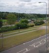
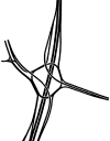
The route starts at the roundabout with the A444, locally known as Whitley Island, and heads east – as a short stretch of D2 dual carriageway (formerly part of the A423) – to reach a roundabout junction with the B4110. From here it continues as the new-build Allard Way, dropping to S2 single carriageway after a few hundred yards. However, there is evidence of future proofing for a dual carriageway here, as there is a very wide railway bridge, and large grass verges either side.
A signalised junction with Second Avenue (to the left) provides access to the former Marconi/GEC works, and the road then continues to another traffic-light-controlled junction, this time with the A428 Binley Road, where it ends. Ahead is the unclassified Hipswell Highway.
History
It is thought that the current line of this road, which dates from the 1980s, was part of a plan for a 'middle' ring road, presumably planned to continue along Hipswell Highway and Sewall Highway, and probably terminating somewhere on the A444 Phoenix Way in the Foleshill area. This is supported to some extent by the DfT road lists of c2002 which lists the A4082 as 'Coventry (Outer Ring Rd)'.
However, there also appears to be a previous route taken by the A4082, with OS Landranger sheets from the mid 1970s showing the current B4082 and former B4481 as the A4082, with the southern section subsequently moved to the current line in the 1980s before the northern section was downgraded to be the B4082.


