Star.pngStar.pngStar grey.pngStar grey.pngStar grey.png

A1077(M)

From Roader's Digest: The SABRE Wiki
Jump to navigation Jump to search
A1077(M)
Location Map ( geo)
20210522 0810 - A1077M south from Frodingham Grange 53.588173N 0.698588W-cropped.JPG
Looking south from Frodingham Grange
Cameraicon.png View gallery (7)
Distance:  1.3 km (0.8 miles)
Meets:  A18 • A1077 • M181
Former Number(s):  M181
Highway Authorities

North Lincolnshire

Traditional Counties

Lincolnshire

Route outline (key)
A1077(M) M180 – Scunthorpe
Junction List
Junc Northbound Southbound
- M181 Start of Road
- A18 Start of Road

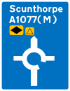
The A1077(M) is a renumbering of a short section of the M181, created in 2021 after a flat roundabout was constructed on the main line of the motorway at Brumby Common Lane. It is entirely D2M and dead straight for around 1.28km, with the road number appearing on signage.

The number "A1077(M)" is possibly temporary, as the construction of a second roundabout on the M181 would likely result in this section of road being downgraded to an A road as part of the A1077.

Links


A1077(M)
Junctions
Related Pictures
View gallery (7)
A1077(M) new scunthorpe motorway sign 1.pngMotorway map of A1077(M) and M18120210522 0810 - A1077M south from Frodingham Grange 53.588173N 0.698588W-cropped.JPG20210522 0807-1 - A1077M flag sign Frodingham Grange 53.588982N 0.697976W - cropped.JPG20210522 0753 - Brumby Common Roundabout 53.576486N 0.701149W - cropped.JPG
Other nearby roads
Scunthorpe
Motorways in Great Britain
Current MotorwaysM1 • M2 • M3 • M4 • M5 • M6 • M6 Toll • M8 • M9 • M11 • M18 • M20 • M23 • M25 • M26 • M27 • M32 • M40 • M42 • M45 • M48 • M49 • M50 • M53 • M54 • M55 • M56 • M57 • M58 • M60 • M61 • M62 • M65 • M66 • M67 • M69 • M73 • M74 • M77 • M80 • M90 • M180 • M181 • M271 • M275 • M602 • M606 • M621 • M876 • M898
A1(M) • A3(M) • A8(M) • A14(M) • A38(M) • A48(M) • A57(M) • A58(M) • A64(M) • A66(M) • A74(M) • A92(M) • A167(M) • A168(M) • A194(M) • A195(M) • A308(M) • A329(M) • A404(M) • A601(M) • A627(M) • A635(M) • A666(M) • A823(M) • A1058(M) • A1077(M)
Motorway Spurs • (M4 Heathrow Spur • M25 T5 Spur • Walton Summit M'way)
Former MotorwaysM10 • M15 • M16 • M30 • M41 • M52 • M62 • M63 • M64 • M65 • M68 • M85 • M110 • M111 • M270 • M274 • M531 • M600
A2(M) • A4(M) • A5(M) • A8(M) • A11(M) • A18(M) • A20(M) • A21(M) • A23(M) • A36(M) • A40(M) (Central London) • A40(M) (Buckinghamshire) • A41(M) • A46(M) • A48(M) (Morriston) • A48(M) (Port Talbot) • A65(M) • A102(M) (North) • A102(M) (South) • A423(M) • A446(M) • A604(M) • A638(M) • A696(M) • A1231(M) • A6127(M) • A6138(M) • A6144(M)
Unbuilt MotorwaysM4 Toll • M12 (Woodford - Brentford) • M12 (Woodford - Maplin) • M12 (Brentwood - -Chelmsford) • M13 • M17 • M19 • M31 • M58 • M59 • M60 • M62 RR • M64 • M81 • M82 • M83 • M100 • M272 • M601 • M650
A2(M) • A6(M) (West) • A6(M) (East) • A14(M) • A48(M) • A59(M) • A61(M) • A556(M) • A695(M)
A Ring • Bilston Link • Belmont Link • B-W M'way • CME Bypass • CMW • Central Spine • Chippenham Spur • Coventry N-S M'way • Cublington Airport M'way • Denham Spur • Derby Urban M'way • Droitwich-Leicester M'way • East Coast M'way • EXR • East Kilbride M'way • E-W Underground M'way • Eastern M'way • Euroroute • Friars Goose Xing • Furness Link • Glasgow IRR • GM Western Relief Road • Hamilton-Cumbernauld M'way • Hook Road • Johnstone M'way • Kendal Link • Liverpool Inner M'way • LOX M'way • Malvern Radial • Manchester IRR • Morecambe Link • NE Urban M'way • NXR • N&W M'way • Paisley-Hamilton M'way • POLO • Princess P'way M'way • Reading Urban M'way • Ringway 2 • Sheffield Spur • S Bristol Spur • SCRPDR • SXR • Stirling Corner Link • Strensham-Solihill M'way • Strensham-Solihill M'way • TGAAR • Townhill Link • Trafford Park M'way • Warndon Radial • Watford Urban M'Way • Western Orbital • Weston Spur


SABRE - The Society for All British and Irish Road Enthusiasts
Discuss - Digest - Discover - Help