A4032 (Hagley)
Jump to navigation
Jump to search

| A4032 | ||||
| Location Map ( geo) | ||||
| ||||
| Park Road | ||||
| From: | Bromsgrove Road (SO913806) | |||
| To: | Kidderminster Road (SO911805) | |||
| Distance: | 0.2 miles (0.3 km) | |||
| Met: | A491, A456 | |||
| Now part of: | Unclassified | |||
| Traditional Counties | ||||
| Route outline (key) | ||||
| ||||
This article is about the former A4032 in Worcestershire.
For the current A4032 in Bristol, see A4032.
For the current A4032 in Bristol, see A4032.

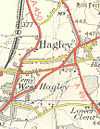
The A4032 Park Road turned off the A491 Bromsgrove Road; both are now unclassified
The original allocation of the A4032 number was to a short link road in Hagley, northern Worcestershire.
The road started on the southern edge of Hagley on the A491 Bromsgrove Road. It headed west along the semi-rural Park Road and ended shortly afterwards at a crossroads on the A456 Kidderminster Road. Park Road continued on the far side but became the B4187.
The A4032 was declassified when the A491 bypass was built, taking that road away from Bromsgrove Road. The western half of the ex-A4032 has been rerouted to join a roundabout on the bypass; the old alignment is still largely in situ as as an access road but has been blocked off at its western end.


