A4046
| A4046 | |||||||
| Location Map ( geo) | |||||||
| |||||||
| From: | Aberbeeg (SO208019) | ||||||
| To: | Bryn-Serth (SO141114) | ||||||
| Via: | Ebbw Vale | ||||||
| Distance: | 7.6 miles (12.2 km) | ||||||
| Meets: | A467, A4281, A4047, A4???, A465 | ||||||
| Former Number(s): | A4047 | ||||||
| Old route now: | A4281 | ||||||
| Highway Authorities | |||||||
| Traditional Counties | |||||||
| Route outline (key) | |||||||
| |||||||
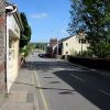
The A4046 runs along the Ebbw Valley from the A467 at Aberbeeg, near Abertillery, northwards to the A4047 at Bryn Serth.
The road starts at a roundabout on the A467 at Aberbeeg. Heading upstream, that road moves from the valley of the Ebbw River to the Ebbw Fach, with the A4046 continuing along the Ebbw.
Initially wooded, the road soon becomes built-up and remains so for almost all the remainder of the road. It passes through Cwm before meeting the B4486 and passing Ebbw Vale Parkway station. Bearing left at a roundabout with the A4281 the road crosses the railway line into Ebbw Vale, which reopened in May 2015.
Continuing north the road follows a new alignment through Ebbw Vale itself, where the road follows a relief road, a mixture of D1 and S2, tight up against the town centre. Rejoining its original route the road reaches a roundabout where it used to split. The mainline bears left and soon meets the A4047 whilst the former mainline, now A4281, continues ahead to cross the A4047 and end at a roundabout on the A465.
The road's northern end has always been on the A465. The original route of that road is now numbered A4047; when the bypass was built the A4046 was extended slightly to meet it (this is now A4281). Confusingly the original number of the (now-former) spur was A4047 but this presumably became the A4046 well before the current A4047 gained its number. When the A4281 was created in 2015, it took over the mainline to the A465, leaving the spur as the mainline. This mainline was extended at the end of August 2015, when the A465 dualled route opened, to Ebbw Vale West Junction.


