A4009
Jump to navigation
Jump to search

| A4009 | ||||
| Location Map ( geo) | ||||
| ||||
| From: | Caversham (SU715750) | |||
| To: | Nettlebed (SU702867) | |||
| Via: | Peppard Common | |||
| Distance: | 8 miles (12.9 km) | |||
| Met (1932): | A32, A415 | |||
| Now part of: | B481 | |||
| Primary Destinations | ||||
| Traditional Counties | ||||
| Route outline (key) | ||||
| ||||

The former A4009 (now B481) near Nettlebed
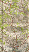
The A4009 was originally allocated to the road from the A32 (renumbered A4155 in 1935) at Caversham to the A415 (renumbered A423 in 1935, then A4130 in the 1990s) at Nettlebed.
Starting in Caversham, in the ever-growing suburbs of Reading, the road headed north. It passed through Sonning Common before a few bends took the road to Peppard Hill, where it climbed up into the Chilterns. The road continued north along the top of the ridge and passed through Highmoor before a wooded section took it to its northern end at Nettlebed, where it ended to the east of the village centre.
Today, the road has been downgraded to a southern extension of the B481.

