Star.pngStar.pngStar grey.pngStar grey.pngStar grey.png

A6003

From Roader's Digest: The SABRE Wiki
Jump to navigation Jump to search
A6003
Location Map ( geo)
Cameraicon.png View gallery (5)
From:  Barton Seagrave (SP896761)
To:  Oakham (SK870085)
Via:  Kettering
Distance:  22.9 miles (36.9 km)
Meets:  A6, A14, A6098, A509, A6900, A4300, B575, A6013, A43, A6183, A6014, A427, A6116, B670, B672, B664, A47, B641, A606, B640
Former Number(s):  A6, B668
Old route now:  A6900, B641
Primary Destinations
Highway Authorities

Leicestershire • Rutland • North Northamptonshire

Traditional Counties

Leicestershire • Northamptonshire • Rutland

Route outline (key)
A6003 Barton Seagrave – Kettering Northern bypass
(A43) Kettering – Barford Bridge
A6003 Barford Bridge – Oakham

Route

Uppingham Road, Corby

The A6003 is one of the more important 4-digit roads in the East Midlands.

It starts in Northamptonshire at A14 J10, where it also meets the A6, at Barton Seagrave, south of Kettering, and takes the route through the town itself, passing to the west of the town centre. It then meets the A43 northern bypass and multiplexes north along that road for a mile or so before turning off, now with primary status.

The road bypasses Corby to the west and then enters Leicestershire and then Rutland a few hundred yards later. From here, it's a more rural drive up to Uppingham. The road runs to the west of Rutland Water before ending on the A606 Oakham bypass.

History

The original A6003

The classification A6003 originally applied only to a part of London Road and Silver Street (shown on today's maps as A6900) in Kettering, forming a link between the A6 and A43. However, it quickly took over the route of the B668 as far as Oakham, which remains the case today, bypasses apart.

The southern section is the old A6, which now multiplexes with the A14 to the west of town.

The multiplex along the A43 north of Kettering dates to 2014, when that road was rerouted along a short stretch of the A6003 before turning onto the new Geddington bypass.


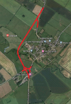
A6003
Junctions
Crossings
Places
Related Pictures
View gallery (5)
A6003, Uppingham Road, Corby - Geograph - 1419865.jpgA6003 Caldecott Bypass - Coppermine - 16941.jpg20160310-0944 - A6003 Catmos Street Pre Warboys Sign, Rutland (B641) 52.6695362N 0.726595W.jpgCaldecott Bypass.pngIMG 6897.JPG Uppingham Rutland 2.jpg
Other nearby roads
Kettering
A6 • A14 • A43 • A509 • A604 • A4300 • A5002 (Northamptonshire) • A6013 (Kettering) • A6098 • A6183 • A6900 • B575 • B668 • B5323 • B5387 • E24 • T12 (Britain) • T47 (Britain)
Oakham
A606 • B640 • B641 • B668 • B673 (Rutland)
Corby
A43 • A427 • A4300 • A6014 • A6086 • A6116 • A6183 • B664 (Corby) • B667 (Islip - Stanion) • B668 • B670 • B6481 (Corby) • T47 (Britain)
A6000-A6099
A6000 • A6001 • A6002 • A6003 • A6004 • A6005 • A6006 • A6007 • A6008 • A6009 • A6010 • A6011 • A6012 • A6013(N) • A6013(S) • A6014 • A6015 • A6016 • A6017 • A6018 • A6019
A6020 • A6021 • A6022 • A6023 • A6024 • A6025 • A6026 • A6027 • A6028 • A6029 • A6030 • A6031 • A6032 • A6033 • A6034 • A6035 • A6036 • A6037 • A6038 • A6039
A6040 • A6041 • A6042 • A6043 • A6044 • A6045 • A6046 • A6047 • A6048 • A6049 • A6050 • A6051 • A6052 • A6053 • A6054 • A6055 • A6056 • A6057 • A6058 • A6059
A6060 • A6061 • A6062 • A6063 • A6064 • A6065 • A6066 • A6067 • A6068 • A6069 • A6070 • A6071 • A6072 • A6073 • A6074 • A6075 • A6076 • A6077 • A6078 • A6079
A6080 • A6081 • A6082 • A6083 • A6084 • A6085 • A6086 • A6087 • A6088 • A6089 • A6090 • A6091 • A6092 • A6093 • A6094 • A6095 • A6096 • A6097 • A6098 • A6099
Earlier uses: A6002 • A6006 • A6009 • A6010 • A6011 • A6014 • A6019 • A6020 • A6021 • A6027 • A6030 • A6055 • A6063 • A6065 • A6067 • A6075 • A6077 • A6078 • A6086 • A6096 • A6099

SABRE - The Society for All British and Irish Road Enthusiasts
Discuss - Digest - Discover - Help