Star.pngStar.pngStar grey.pngStar grey.pngStar grey.png

B1600

From Roader's Digest: The SABRE Wiki
Jump to navigation Jump to search
B1600
Location Map ( geo)
Cameraicon.png View gallery (7)
From:  Forth Street (NZ243636)
To:  Jesmond Dene Road (NZ250671)
Via:  Quayside
Distance:  3.5 miles (5.6 km)
Meets:  A695, A186, A193, B1307, A1058, A189
Former Number(s):  B6333, B6334, B1304, B1308, B1309
Primary Destinations
Highway Authorities

Newcastle upon Tyne

Traditional Counties

Northumberland

Route outline (key)
B1600 Westgate - Forth Street
B1600 Newcastle - Jesmond

The B1600 is an urban B-road in Newcastle upon Tyne, whose southern section is signed as a partial Ring Road of the city centre. This was intended as a temporary measure pending construction of the city's motorway network in the 1960s and 1970s, and has persisted despite the opening of the Central Motorway East (A167(M)) making parts of it redundant.

Osborne Road, Jesmond

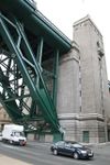
The B1600 starts behind the International Centre for Life in central Newcastle, at the junction of Railway Street and Forth Street. The route passes along Forth Street, then southwards down the steep Forth Banks to the banks of the River Tyne. The route turns sharply eastwards onto Close, and passes beneath the Queen Elizabeth II Bridge, past the Swing Bridge, and beneath the Tyne Bridge, running as Quayside along the riverside before climbing northwards. At this point the B1600 splits in two: the westward arm being Gibson Street/Clarence Street/Shieldfield Lane, the eastward being Crawhall Road and Stoddart Street. Both routes cross the A193 New Bridge Street, and meet at a roundabout on Stoddart Street.

The reunited route continues northward along Stoddart Street, Portland Road and Portland Terrace before meeting the A1058 Jesmond Road. Here it makes a brief westward dog-leg, duplexing with the A-road, before heading north again on Osborne Road. Osborne Road is the main 'spine' road of the prosperous suburb of Jesmond and is noted for the number of hotels, most with lively bars and restaurants, which in the last decade has led to Jesmond becoming a night-life rival to the Quayside and Bigg Market areas. As the B1600 passes through the glitzy section of the road, a 20 mph speed limit is imposed. The route continues north up to the light-controlled junction where the B1600 meets the A189 Jesmond Dene Road.

The B1600 was cobbled together out of pre-existing B-roads in the 1980s to form an apparently coherent whole, explaining its unusual route and high number. When originally formed it continued further west from its present southern end along George Street and Rye Hill to meet the A186 Westgate. This is now unclassified, although some maps still claim that the easternmost section of Elswick Road is numbered B1600.


B1600
Junctions
Places
Related Pictures
View gallery (7)
Osborne Road, Jesmond - Geograph - 1127473.jpgView under bridge - Geograph - 974109.jpgGibson Street - Geograph - 5080231.jpgTyne-br3.jpgRye Hill House, Newcastle College - Geograph - 1751683.jpg
Other nearby roads
Newcastle upon Tyne
A1 • A1(M) • A1(M)/Newcastle Central Motorway East • A1/Sandbox • A69 • A108 (Seaham - Seaton Burn) • A167 • A167(M) • A184 • A186 • A187 • A188 • A189 • A191 • A193 • A695 • A695(M) • A696 • A696(M) • A1056 (Northumberland) • A1057 (Newcastle upon Tyne) • A1058 • A1058(M) • A1059 (Newcastle upon Tyne) • A1060 (Newcastle upon Tyne) • A6082 • A6085 • A6086 (Newcastle-upon-Tyne) • A6115 (Tyneside) • A6125 • A6126 • A6127 • A6127(M) • B1296 • B1304 (Newcastle) • B1305 • B1305 (Quayside, Newcastle) • B1306 (Newcastle) • B1307 • B1308 (Newcastle) • B1309 • B1309 (Jesmond) • B1310 • B1311 • B1311 (Byker) • B1312 • B1312 (Byker) • B1313 • B1314 • B1318 • B6323 • B6324 • B6325 (Newcastle) • B6326 (Newcastle) • B6327 • B6328 • B6329 • B6330 • B6331 • B6332 • B6333 • B6334 • B6335 • B6336 • B6337 • B6338 • B6339 • B6340 (Gosforth) • B6431 (Newcastle upon Tyne) • B6440 • B6528 • B6534 • C101 (Newcastle upon Tyne) • C103 (Newcastle upon Tyne) • C104 (Newcastle upon Tyne) • C105 (Newcastle upon Tyne) • C106 (Newcastle upon Tyne) • C107 (Newcastle upon Tyne) • C108 (Newcastle upon Tyne) • C109 (Newcastle upon Tyne) • C110 (Newcastle upon Tyne) • C111 (Newcastle upon Tyne) • C112 (Newcastle upon Tyne) • C113 (Newcastle upon Tyne) • C114 (Newcastle upon Tyne) • C115 (Newcastle upon Tyne) • Central Motorway East Bypass • Central Motorway West • E15 • E18 • E31 (via Newcastle) • E110 (Old System) • East-West Underground Motorway • Friars Goose Crossing • T1 (Britain) • T25 (Britain) • T86 (Britain)
B1500 – B1619
B1500 • B1501 • B1502 • B1503 • B1504 • B1505 • B1506 • B1507 • B1508 • B1509 • B1510 • B1511 • B1512 • B1513 • B1514 • B1515 • B1516 • B1517 • B1518 • B1519
B1520 • B1521 • B1522 • B1523 • B1524 • B1525 • B1526 • B1527 • B1528 • B1529 • B1530 • B1531 • B1532 • B1533 • B1534 • B1535 • B1536 • B1537 • B1538 • B1539
B1540 • B1541 • B1542 • B1543 • B1544 • B1545 • B1546 • B1547 • B1548 • B1549 • B1550 • B1551 • B1552 • B1553 • B1554 • B1555 • B1556 • B1557 • B1558 • B1559
B1560 • B1561 • B1562 • B1563 • B1564 • B1565 • B1566 • B1567 • B1568 • B1569 • B1570 • B1571 • B1572 • B1573 • B1574 • B1575 • B1576 • B1577 • B1578 • B1579
B1580 • B1581 • B1582 • B1583 • B1584 • B1585 • B1586 • B1587 • B1588 • B1589 • B1590 • B1591 • B1592 • B1593 • B1594 • B1595 • B1596 • B1597 • B1598 • B1599
B1600 • B1601 • B1602 • B1603 • B1604 • B1605 • B1606 • B1607 • B1608 • B1609 • B1610 • B1611 • B1612 • B1613 • B1614 • B1615 • B1616 • B1617 • B1618 • B1619

SABRE - The Society for All British and Irish Road Enthusiasts
Discuss - Digest - Discover - Help