Star.pngStar.pngStar grey.pngStar grey.pngStar grey.png

B1307

From Roader's Digest: The SABRE Wiki
Jump to navigation Jump to search
B1307
Location Map ( geo)
Cameraicon.png View gallery (4)
From:  Askew Road (NZ253634)
To:  Jesmond Road (NZ258656)
Via:  Percy Street, Sandyford Road
Distance:  2.5 miles (4 km)
Meets:  A184, B1600, A186, B1311, B1318, B1309, B1600, A1058
Former Number(s):  A6125
Primary Destinations
Highway Authorities

Gateshead  • Newcastle upon Tyne

Traditional Counties

Durham • Northumberland

Route outline (key)
B1307 Gateshead - Jesmond
B1307 Manors - Portland Road
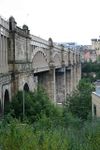
The carriageway of the High Level Bridge

The B1307 is a complicated B-road on Tyneside.

It starts in Gateshead on the A184 Askew Road. It then heads north-west along Wellington Street, becoming one-way southbound as it crosses the High Level Bridge into Newcastle upon Tyne. Most maps still show the bridge as being B1307 even though it is now only open to buses and taxis – quite a change from 1922 when it carried the A1!

After a short multiplex along the A186 by the cathedral, the B1307 continues north along Groat Market, Bigg Market and Newgate Street, again as a southbound only route. Crossing Clayton Street it becomes two-way, but is also again accessible only to buses and taxis in both directions, before it meets the B1311 Gallowgate at a crossroads. Here the B1307 continues more conventionally as a fully accessible two-way road and it continues along Percy Street to reach the B1318 Barras Bridge. This is where the ex-A1 continues straight and the B1307 turns right into St Mary's Place.

The B1307 then meets the B1309 (which goes down Durant Road to meet the A167(M) at New Bridge Street Roundabout) and then continues past Northumbria University before going under the A167(M) to cross the B1600. It then goes along Sandyford Road to end on the A1058 Jesmond Road.

The only part of the original route of the B1307 that is still followed by the current road is Sandyford Road. The B1307 originally started on the A695 Melbourne Street and headed north along Trafalgar Street before zigzagging into Chester Street. This section was largely taken over when the A1(M) (now A167(M)) was built and so some is unclassified and some destroyed.



B1307
Crossings
Places
Related Pictures
View gallery (4)
High-level-br1.jpgHigh-level-br2.jpgTyne-brs.jpgThe southern end of Bigg Market,... (C) Bill Henderson - Geograph - 256160.jpg
Other nearby roads
Gateshead
A1(M) • A69 • A167 • A184 • A185 • A185(M) • A189 • A194(M) • A195 • A613 (Gateshead) • A692 • A1114 (Gateshead) • A6081 • A6082 • A6083 • A6084 • A6115 (Tyneside) • A6125 • A6126 • A6127 • A6171 • B601 • B1288 • B1295 (Gateshead) • B1296 • B1296 (Gateshead - Heworth) • B1426 • B6317 • Central Motorway East Bypass • E15 • E31 (via Newcastle) • Friars Goose Crossing • M100 • T1 (Britain) • T25 (Britain)
Newcastle upon Tyne
A1 • A1(M) • A1(M)/Newcastle Central Motorway East • A1/Sandbox • A69 • A108 (Seaham - Seaton Burn) • A167 • A167(M) • A184 • A186 • A187 • A188 • A189 • A191 • A193 • A695 • A695(M) • A696 • A696(M) • A1056 (Northumberland) • A1057 (Newcastle upon Tyne) • A1058 • A1058(M) • A1059 (Newcastle upon Tyne) • A1060 (Newcastle upon Tyne) • A6082 • A6085 • A6086 (Newcastle-upon-Tyne) • A6115 (Tyneside) • A6125 • A6126 • A6127 • A6127(M) • B1296 • B1304 (Newcastle) • B1305 • B1305 (Quayside, Newcastle) • B1306 (Newcastle) • B1308 (Newcastle) • B1309 • B1309 (Jesmond) • B1310 • B1311 • B1311 (Byker) • B1312 • B1312 (Byker) • B1313 • B1314 • B1318 • B1600 • B6323 • B6324 • B6325 (Newcastle) • B6326 (Newcastle) • B6327 • B6328 • B6329 • B6330 • B6331 • B6332 • B6333 • B6334 • B6335 • B6336 • B6337 • B6338 • B6339 • B6340 (Gosforth) • B6431 (Newcastle upon Tyne) • B6440 • B6528 • B6534 • C101 (Newcastle upon Tyne) • C103 (Newcastle upon Tyne) • C104 (Newcastle upon Tyne) • C105 (Newcastle upon Tyne) • C106 (Newcastle upon Tyne) • C107 (Newcastle upon Tyne) • C108 (Newcastle upon Tyne) • C109 (Newcastle upon Tyne) • C110 (Newcastle upon Tyne) • C111 (Newcastle upon Tyne) • C112 (Newcastle upon Tyne) • C113 (Newcastle upon Tyne) • C114 (Newcastle upon Tyne) • C115 (Newcastle upon Tyne) • Central Motorway East Bypass • Central Motorway West • E15 • E18 • E31 (via Newcastle) • E110 (Old System) • East-West Underground Motorway • Friars Goose Crossing • T1 (Britain) • T25 (Britain) • T86 (Britain)
B1300 – B1399
B1300 • B1301 • B1302 • B1303 • B1304 • B1305 • B1306 • B1307 • B1308 • B1309 • B1310 • B1311 • B1312 • B1313 • B1314 • B1315 • B1316 • B1317 • B1318 • B1319
B1320 • B1321 • B1322 • B1323 • B1324 • B1325 • B1326 • B1327 • B1328 • B1329 • B1330 • B1331 • B1332 • B1333 • B1334 • B1335 • B1336 • B1337 • B1338 • B1339
B1340 • B1341 • B1342 • B1343 • B1344 • B1345 • B1346 • B1347 • B1348 • B1349 • B1350 • B1351 • B1352 • B1353 • B1354 • B1355 • B1356 • B1357 • B1358 • B1359
B1360 • B1361 • B1362 • B1363 • B1364 • B1365 • B1366 • B1367 • B1368 • B1369 • B1370 • B1371 • B1372 • B1373 • B1374 • B1375 • B1376 • B1377 • B1378 • B1379
B1380 • B1381 • B1382 • B1383 • B1384 • B1385 • B1386 • B1387 • B1388 • B1389 • B1390 • B1391 • B1392 • B1393 • B1394 • B1395 • B1396 • B1397 • B1398 • B1399
Earlier Iterations: B1300 • B1304 • B1305 • B1306(W) • B1306(E) • B1308 • B1309 • B1312 • B1318 • B1320 • B1330 • B1332 • B1333 • B1335 • B1336
B1343 • B1344 • B1345 • B1353 • B1358 • B1360 • B1361(E) • B1361(W) • B1372 • B1373 • B1375 • B1378 • B1380 • B1383 • B1389 • B1392 • B1393 • B1397

SABRE - The Society for All British and Irish Road Enthusiasts
Discuss - Digest - Discover - Help