B4053
| B4053 | ||||
| Location Map ( geo) | ||||
| ||||
| From: | Temple Circus (ST594725) | |||
| To: | Colston Avenue (ST586730) | |||
| Via: | Victoria Street, Baldwin Street | |||
| Distance: | 0.7 miles (1.1 km) | |||
| Meets: | A4, A4044, A38 | |||
| Former Number(s): | A36, A4 | |||
| Primary Destinations | ||||
| Highway Authorities | ||||
| Traditional Counties | ||||
| Route outline (key) | ||||
| ||||
For the original B4053 slightly to the west, now part of the B4051, see B4053 (Colston Street, Bristol).
Route
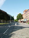
The B4053 runs through the centre of Bristol, bridging a short gap in the route of the A4. From the Temple Circus Gyratory, near Bristol Temple Meads Railway station, it first heads northwestward, as Victoria Street, into the city centre. Crossing Bristol Bridge, the road then turns left and carries on as Baldwin Street before swinging right into Colston Avenue to end at a roundabout junction with the A38.
On the ground, the route is poorly signposted, with no references to the B4053. There is no indication this road can be used as a through route as you are directed around the A4044 Bristol Inner Circuit rather than along this road. Nevertheless, this road is normally quicker due to the number of traffic lights and other junctions on the bypass route.
History
The B4053 used to be the A4 through Bristol, but was originally numbered as the A36 as the A4 finished at Bath; the designation was changed in the 1930s. The A4 was downgraded to the B4053 in the 1960s after the A4044 Bristol Inner Circuit was completed.
From Temple Circus to Bristol Bridge, the road is Victoria Street, which was built in the 1870s as a direct route from the city to Temple Meads station, which is why the road does not follow the grid pattern of other streets in this area. Just before Bristol Bridge, Redcliff Street joins, the former A38, which multiplexed with the A4 across the bridge.
Bristol Bridge was the lowest crossing of the River Avon and gave Bristol its Anglo-Saxon name of Brycgstow (place by the bridge). The original Anglo-Saxon timber bridge was replaced by a stone bridge around 1200, and like many medieval bridges, it had houses and shops on it. The current bridge was opened in 1768 and widened in Victorian times. Until the 1930s, this was the only crossing of the River Avon in Bristol and so was a huge bottleneck. One of the main purposes in building the Bristol Inner Circuit road from the 1930s was to provide a bypass for this bridge.
Bristol Bridge was the meeting point for all the major roads into Bristol. The A4 (although originally the A36 on the 1922 roads list), approached from the South-East, crossed the bridge and then turned westwards to Avonmouth. The A38 approached from the south, crossed the bridge and then headed northwards (although later re-routed to multiplex with the A4 to Colston Avenue before turning north). Lastly, the A420 used to terminate on north side of the bridge as Bridge Street. Today all the remains of the A420 is a 50-yard stub of Bridge Street, but the road used to cross what is now Bristol Park until the 1960s. What is now Bristol Park used to be the main shopping area of Bristol, until it was heavily bombed during the second world war. The A420 was cut back to its present form in the 1960s when the A4044 Bristol Inner Circuit road was completed.
After Bristol Bridge, the A4 turned left and headed down Baldwin Street to St Augustines Reach (one of the docks in Bristol) and the River Frome. The road used to cross the Frome on a stone bridge, but this whole area was paved over in the 1930s when the first parts of the Bristol Inner Circuit road were being built. Today, the B4053 finishes here, but the A4 turned left to head past the Cathedral and out towards Avonmouth.
Links
- History of Bristol Bridge
- Content on Flickr showing Bristol Bridge
- Archive cine film from the 1920s showing various parts of this road


