B6278
| B6278 | ||||
| Location Map ( geo) | ||||
| ||||
| From: | Barnard Castle (NZ054170) | |||
| To: | Shotley Bridge (NZ091527) | |||
| Via: | Egglestone, Stanhope, Edmundbyers | |||
| Distance: | 30.4 miles (48.9 km) | |||
| Meets: | A67, B6279, B6282, A689, B6306, A68, A691, A694 | |||
| Former Number(s): | A691 | |||
| Highway Authorities | ||||
| Traditional Counties | ||||
| Route outline (key) | ||||
| ||||
The B6278 is a long B-road across the Durham Dales.
The road starts on the A67 to the east of Barnard Castle town centre and heads north. It crosses a hill, to parallel the River Tees flowing about a mile to the west (and much lower down). The B6279 and B6282 are met in quick succession and the B6278 is then the dominant partner in a short multiplex with the latter as far as Eggleston, where our road has to TOTSO right with the B6282 continuing ahead along the Tees Valley.
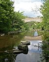
The B6278 then heads north along the valley of the Eggleston Burn and up onto the moors. The climb never seems too strenuous but eventually a summit of over 1600 feet is reached. The road then descends, more steeply this time and via a couple of hairpins, to go over a level crossing on the preserved Weardale Railway and reach Stanhope. The road bends sharply to the left on reaching the River Wear. Straight ahead is a ford, now officially closed to traffic, which used to have numerous warning signs advising drivers not to attempt it. The B6278 follows the river upstream to a hairpin bend over a narrow bridge; it has never crossed the ford.
The A689 is then reached and there is a short multiplex east into town before the B6278 turns left and regains its northerly direction. It climbs steeply onto the next section of moorland; this, however, is not so high as on the other side of the River Wear but it does appear boggier. The road descends to Edmundbyers to meet the B6306 before crossing the River Derwent at the first bridge downstream from the Derwent Reservoir. This is a narrow bridge with tight corners at either side.
Now in Northumberland, the B6278 heads east to meet the A68 at a staggered crossroads. It originally ended here, with the road ahead being the A691. However, that road has since been cut back and so the B6278 now continues across the fields to reach the River Derwent again and cross it at Shotley Bridge. It then climbs to a T-junction and ends. To the left is the A694; to the right, the A691.


