B4333
| B4333 | ||||||||||
| Location Map ( geo) | ||||||||||
| ||||||||||
| From: | Blaenannerch (SN240490) | |||||||||
| To: | Cynwyl Elfed (SN372276) | |||||||||
| Via: | Aberporth, Newcastle Emlyn | |||||||||
| Distance: | 20.8 miles (33.5 km) | |||||||||
| Meets: | A487, A487, B4570, B4571, A475, A484, B4299, A484 | |||||||||
| Highway Authorities | ||||||||||
| Traditional Counties | ||||||||||
| Route outline (key) | ||||||||||
| ||||||||||
Route
The B4333 is a cross-country route in southwest Wales.
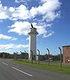
It starts at a roundabout on the A487 at Blaenannerch and heads north past the West Wales Airport, where it reaches a roundabout and turns left. The road to the right was the original line of the B4333, which was severed by an extension of the airport runway in the 2000s.
Continuing north, the B4333 enters Aberporth. It gets as close to the sea as is possible before turning sharply right and heading inland once again. The road heads back to the A487 which it crosses at a staggered crossroads at Tan-y-Groes.
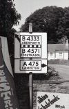
An undulating road takes the B4333 to Beulah and Bryngwyn before the road descends to Cwm-cou where it turns sharply left at the bottom of the hill as it meets the B4570. The road then runs parallel to the River Teifi for over a mile to Adpar. Here it TOTSOs right on meeting the B4571 before reaching a mini-roundabout on the A475 shortly afterwards.
The B4333 now multiplexes along the A475 over the Teifi and through Newcastle Emlyn. It reappears by turning south off the A484 on the eastern side of town. Our road continues southeast, climbing steadily as it does so. It skirts the summit of the Moelfre before reaching its own peak just before a car park. The B4299 heads off to the right near Maudland House and then the road continues along the ridge to Hermon before descending to its terminus at Cynwyl Elfed, where it ends at a T-junction back on the A484.
History
In 1922 the B4333 only covered the short section between Adpar and the A487 at Tan-y-Groes. It was extended into Aberporth in the late 1920s, ending on an unclassified road in the centre of town.
In 1935 the B4333 was extended in both directions, giving it the route it follows today.


