B5053
| B5053 | ||||
| Location Map ( geo) | ||||
| ||||
| From: | Froghall (SK025473) | |||
| To: | Brierlow Bar (SK086698) | |||
| Distance: | 16.7 miles (26.9 km) | |||
| Meets: | A52, A523, B5054, A515 | |||
| Highway Authorities | ||||
| Traditional Counties | ||||
| Route outline (key) | ||||
| ||||
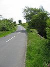
The B5053 is a relatively long rural, upland B-road crossing the Staffordshire Moorlands and running parallel to the A53. It is - and is signposted as - the direct route between Cheadle and Buxton.
The B5053 starts in the Churnet Valley, on the A52 in the hamlet of Froghall. It climbs quickly out of the valley, crossing the Caldon Canal en route at the west end of Froghall Tunnel, ascending over 200 feet in its first half mile. Soon afterwards, it passes through the village of Ipstones, where the High Street narrows to a point where the centre white lines need to disappear. Beyond Ipstones, the B5053 continues to climb, crossing over the Leek to Cauldon railway line (whose future for preservation is currently uncertain) and reaching the A523 at the unusually named hamlet of Bottom House.
Half a mile (and over 100 feet in climb) later, the B5053 enters the Peak District National Park at a crossroads. For some reason, the millstone to mark the park boundary is a short distance further on, close to the summit of the ridge (indeed the summit of the Staffordshire part of the B5053). The road then descends steeply to the village of Onecote, where it crosses the River Hamps. A descent, of course, means that an ascent is coming soon and the B5053 climbs up to Butterton Moor, before a very steep descent to the Warslow Brook, which seems too small a stream to have carved out such a deep valley. On the far side, however, the climb is much less and the village of Warslow is reached without too much strain on the engine.
A few hundred yards after Warslow, the B5054 is reached which turns off to the right towards Hartington. We, however, descend to pass through two wooded areas by Warslow Hall before crossing a series of small streams, some in quite shallow valleys, others making the road quite steep. Eventually we cross the River Manifold - the widest river crossed by the B5053, although its valley is quite shallow. A few hundred yards further on is the village of Longnor. The B5053 passes the western end of its market square, suggesting that the village was once quite important. Indeed, the road crossing at the village's main crossroads is, although unclassified, the main road between Leek and Bakewell (and is given importance beyond its status by Google Maps!).
The B5053 through Longnor is narrow but we soon leave the village behind and run along the top of a ridge. About half a mile further on, the road starts to descend steeply. This section of road is, once again, too narrow for centre white lines. Indeed it is so narrow that the Council have installed traffic lights so that only a single lane of traffic can pass at any one time. A passing place is visible on the left about half way along; obviously widening the road is not currently possible! At the end of the light-controlled section we continue to descend to reach the River Dove at Glutton Bridge and enter Derbyshire.
The B5053 passes between Hitter Hill (to the right) and the more unusually shaped Parkhouse Hill (to the left) before climbing Glutton Dale to pass by the village of Earl Sterndale. It climbs further along the side of a ridge, with wonderful views to the left, before reaching its summit at Brier Low, where the road leaves the Peak District. The road now descends, passing between two limestone quarries, although the landscaping means they are hard to spot. The B5053 goes underneath the railway line which still exists to serve the quarries. This was originally built as the Cromford & High Peak Railway; after the line was closed much of it was turned into the High Peak Trail which starts a couple of miles away to the southeast.
Now virtually dead straight, the B5053 continues downhill to Brierlow Bar, a surprisingly complicated junction. There is access to a large bookshop to the right, just before a minor road (signposted Harpur Hill) joins from the left. About 50 yards later, the B5053 comes to an end on the A515, from which there is also access to the bookshop. The A5270 is a couple of hundred yards away to the right and Buxton a couple of miles to the left.


