B5061
| B5061 | ||||||||||
| Location Map ( geo) | ||||||||||
| ||||||||||
| From: | Priorslee (SJ706097) | |||||||||
| To: | Attingham Park (SJ556093) | |||||||||
| Distance: | 7.8 miles (12.6 km) | |||||||||
| Meets: | A5, A442, A5223, M54, A5, B4394, B4380 | |||||||||
| Former Number(s): | A5, A41, A464 | |||||||||
| Primary Destinations | ||||||||||
| Highway Authorities | ||||||||||
| Traditional Counties | ||||||||||
| Route outline (key) | ||||||||||
| ||||||||||
For more detailed information about the original route of the B5061 in Wellington, see B5061 (Wellington).
The B5061 follows a 16-km (10-mile) stretch of the route of Thomas Telford's Holyhead Road between Priorslee, on the east side of Telford, and Atcham, east of Shrewsbury, as well as part of Watling Street where the two routes co-incided. Some 0.8 miles (1.3 km) of the direct route, immediately to the south of Oakengates town centre, was unclassified for a number of years, leading to a gap in the B5061; though this is no longer the case.
Route
The first section of the B5061 starts at Priorslee Roundabout, Telford, where the present-day route of the A5 crosses Thomas Telford's Holyhead Road. It passes through commercial and industrial land, before terminating at Greyhound Roundabout, where it meets the A442, around 0.6 miles later.
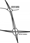
However, in late 2010, signage appeared over the section between Beveley Roundabout (the junction of Holyhead Road and the B4373) to the west of Oakengates, and Ketley Brook Roundabout (with the A5223) indicating that this section had also become part of B5061. There is currently no signage indicating that the remaining "missing" section of Holyhead Road between the B4373 and the A442 is classified. However, the two different 2016 edition Ordnance Survey sheets (Stafford and Telford OS Landranger and the 2016 OS Road Map Wales and West Midlands) both claim that the missing section is indeed part of the B5061, though no signage confirms this fact.
From Ketley Brook Roundabout, where the route meets the A5223, the road continues west, initially passing Telford College and Bucks Head, the home ground of AFC Telford United before entering primarily residential areas. After a short distance, there is a light-controlled crossroads at The Cock, a formerly notorious bottleneck where the routes of the A5 from east to west crossed the A442 from north to south.
The road is quite narrow all the way through Wellington, though it avoids the town centre passing a short distance to the south.
Once it leaves the urban area of Telford, there is almost immediately a short spur to the south to meet M54 junction 7, the western terminus of the motorway. The main route continues westwards, passing into open countryside where the road is of a good quality, initially running along the northern side of the A5 before avoiding Overley Hill to the north, followed by a turn to the southwest, passing underneath the A5 before leaving the line of Watling Street at the Horseshoe Inn, northeast of Wroxeter.
In the remaining short distance of the road, it passes through the hamlet of Norton, before terminating on the B4380 south of Attingham Park.
History
In the 1922 Road Lists, B5061 is listed as "Link at Wellington", to the north of the present route. It followed Haygate Road from the A5 into the town centre, and Church Street and Park Street back out to the original route of A442 at King Street.
The exact sequence of events in the change in routing of B5061 is currently unclear. It is certain that the old A5 route between Priorslee and Cluddley became mostly B5061 (and a stretch of A518) around the time of the opening of the M54 Wellington Bypass in 1975. However, some mapping dated prior to the opening of the M54 has the original B5061 routing into Wellington town centre marked as an A-road, although no numbering is given. This is still the case just post-opening of the M54 - with the original B5061 numbered A5223, though again not all mapping from the time agrees, and road numbering in the Telford area was in such a state of flux from around 1975 to 1990 that even Ordnance Survey 1:50000 sheets seem to show individually conflicting items.
More research into this timescale is therefore required.
The extension of the B5061 west from Cluddley to Attingham took place when the current route of the A5 was built in the 1990s - although again here there is debate as to exactly when as some early maps show the old road as unclassified.


