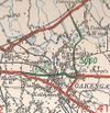
B5060 (Oakengates)
| B5060 | |||||||
| Location Map ( geo) | |||||||
| |||||||
| From: | Snedshill (SJ701136) | ||||||
| To: | Donnington (SJ700101) | ||||||
| Via: | St. George's | ||||||
| Distance: | 2.4 miles (3.9 km) | ||||||
| Met (1961): | A5, B5406, A518 | ||||||
| Former Number(s): | A5 | ||||||
| Primary Destinations | |||||||
| Traditional Counties | |||||||
| Route outline (key) | |||||||
| |||||||
For the later B5060, a road also in the Telford area that ran between the M54 and A518, see B5060 (Priorslee - Muxton).
The original B5060 has a somewhat confusing history, starting life as a road that ran east-west, and ending it as a road that ran north-south.
In the original 1922 listings, B5060 was allocated to Link in Oakengates. This was actually a small part of Watling Street in eastern Shropshire, through what is now part of Telford. Starting in Ketley the road headed east via Oakengates town centre, and finally up a rather steep hill into St. George's. Presumably due to this steep hill, most traffic avoided this small section of Watling Street and instead diverted via the Holyhead Road before turning northwards along Furnace Road and Stafford Street before rejoining Watling Street in the centre of St. George's. This busier route, therefore, became the A5, whilst the original line of Watling Street was considered sufficiently busy to become B5060.
By the time of publication of the relevant 1926-27 MoT Map, it was realised that the route north of St. George's to Donnington via Gower Street, St. George's Road and Wrekin Drive was sufficiently busy to be upgraded to a B-class road, and so B5060 was extended over this route. This meant that A5 and B5060 met at a cannon, and that B5060 became an L-shaped route rather than an east-west route.
In 1932, the St. George's Bypass along what is now Snedshill Way and the carefully named "St. George's Bypass" opened to the east of the village. The A5 was therefore rerouted along the bypass, meeting the then-A41 Holyhead Road slightly to the east of its former location. The old route of the A5 through the centre of St. Georges then required a B-class number. Presumably in order to simplify the route numbering in the area, it was decided to allocate different numbers to the north-south route and east-west route that met in the centre of St. George's. Oddly, the B5060 number was allocated to the north-south route, whilst the east-west route gained the B5406 number. This meant that none of the original B5060 was part of the post-1932 route.
The north-south route was upgraded to A5266 in the mid-1970s. Both the north-south and east-west routes have since been declassified.


