B5021 (Derby City Centre)
Jump to navigation
Jump to search
| B5021 | ||||
| Location Map ( geo) | ||||
| ||||
| From: | Morledge (SK354362) | |||
| To: | Curzon Street (SK347362) | |||
| Distance: | 0.5 miles (0.8 km) | |||
| Met: | B6000, A6, A516 | |||
| Traditional Counties | ||||
| Route outline (key) | ||||
| ||||
This article is about the original B5021 in Derby City Centre.
For the present B5021 in Littleover, Derby, see B5021.
For the present B5021 in Littleover, Derby, see B5021.
The B5021 was a short link road in Derby city centre.
It started on the then-B6000 Morledge and headed west along East Street, St Peter's Churchyard and Macklin Street before making a right turn and running along part of Abbey Street. It ended at its junction with Curzon Street, which was at the time the A516.
The road is now unclassified and partly pedestrianised. It is wholly within the inner ring road.
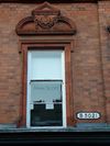
There is still a sign at the junction of St Peter's Churchyard and St Peter's Street (right in the centre of Derby) reading B5021.


