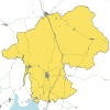
Westmorland
| Westmorland | |||
| Location Map ( geo) | |||
 | |||
| |||
| Primary Destinations | |||
| Brough • Kendal • Kirkby Lonsdale • Windermere | |||
| Current Highway Authorities | |||
| Westmorland and Furness Council | |||
| Borders | |||
| Cumberland • Durham • Lancashire • Yorkshire | |||
| National Highways Roads | |||
| M6 • A66 • A590 | |||
Westmorland is a traditional county in the North-West of England. It is administered by Westmorland and Furness Council.
Geography & Economy
Westmorland is a rural county stretching from the Lake District to the Pennines; as such much of the county is mountainous. The Eden Valley in the north is the largest area of flat land and the county does have a short coastline on Morecambe Bay. Westmorland has two separate borders with Lancashire; presumably crossing Westmorland on land was not as easy as crossing Morecambe Bay. The county contains the Lake District's eastern fells and the tourist trap of Ambleside. By a quirk of geography it also contains the whole of Windermere, as the county boundary follows the lake edge. Hills outside the Lake District are more poorly known, although the county does contain Great Dun Fell (known for its "golf ball" radar station on the summit; the private road leading there is the country's highest tarmacked road) and part of the Howgills, now in the Yorkshire Dales National Park.
Roads
Owing to the geography of Westmorland its road network is limited. A number of roads radiate from Kendal, the county's most important Primary Destination, to serve the south of the county - but there are limited routes north over the fells. The A6 over Shap was notorious in winter until replaced by the M6 along the Lune Gorge in 1970. In the north, roads radiate from Penrith, which is a mile or so over the county boundary in Cumberland, but again few roads head east across the Pennines. Westmorland is also the location for the inland Windermere Ferry, which takes B5285 traffic into Lancashire. National Highways maintain the county's three trunk roads, the north-south M6, the transpennine A66 and the A590 to Furness. Non-trunk roads in the county are maintained by Westmorland and Furness Council. Westmorland is in the dubious position of containing two of the country's smallest Primary Destinations: Brough and Kirkby Lonsdale.
| Route | From | To | Length | |
|---|---|---|---|---|
| M6 | Catthorpe, Leicestershire | Gretna, Dumfriesshire | 236 miles | View |
| A6 | Luton | Carlisle | 299 miles | View |
| A65 | Leeds | Kendal | 69 miles | View |
| A66 | Workington | Grangetown | 115 miles | View |
| A590 | Crooklands | Walney Island | 34.9 miles | View |
| A591 | Levens | Bothel | 44.9 miles | View |
| A592 | Newby Bridge | Penrith | 34.3 miles | View |
| A593 | Broughton in Furness | Ambleside | 16.6 miles | View |
| A683 | Heysham | Kirkby Stephen | 43.2 miles | View |
| A684 | Kendal | Osmotherley | 67.1 miles | View |
| A685 | Kendal | Brough | 27.0 miles | View |
| A5074 | Levens Bridge | Windermere | 11.2 miles | View |
| A5075 | Waterhead, Ambleside | Ambleside | 0.5 miles | View |
| A5284 | Kendal | Plumgarths, Kendal | 1.5 miles | View |
| A6070 | M6 J35 | Crooklands | 7.2 miles | View |
| B5277 | Meathop | Flookburgh | 6.6 miles | View |
| B5282 | Milnthorpe | Arnside | 3.8 miles | View |
| B5284 | Kendal bypass | Storrs | 6.1 miles | View |
| B5285 | Coniston | Longtail | 8.8 miles | View |
| B5286 | Hawkshead | Clappersgate | 3.6 miles | View |
| B5287 | Town End | Fairy Glen | 0.9 miles | View |
| B5320 | Waterfoot | Eamont Bridge | 4.9 miles | View |
| B5343 | Skelwith Bridge | Middle Fell Farm, Rossett | 5.0 miles | View |
| B5360 | Storrs (S) | Blackwell | 1.0 mile | View |
| B6254 | Carnforth | Kendal | 21.5 miles | View |
| B6256 | White Hall, Sedbergh | Four Lane Ends | 1.1 miles | View |
| B6257 | Bridge End, Sedbergh | Grayrigg Common | 4.6 miles | View |
| B6258 | Sedbergh | Kirkby Stephen | 11.7 miles | View |
| B6259 | Sandford | Moorcock Inn, Garsdale | 17.2 miles | View |
| B6260 | Tebay | Appleby-in-Westmorland | 11.9 miles | View |
| B6261 | Shap (S) | Gaisgill | 7.9 miles | View |
| B6262 | Lowther Bridge | Lightwater Bridge | 1.3 miles | View |
| B6270 | Downholme | Nateby | 26.6 miles | View |
| B6276 | Brough | Middleton in Teesdale (S) | 13.6 miles | View |
| B6384 | Milnthorpe | Clawthorpe | 3.4 miles | View |
| B6385 | Crooklands | Milnthorpe | 3.0 miles | View |
| B6412 | Temple Sowerby | Lazonby | 11.7 miles | View |
| B6434 | Stramongate Bridge | Nether Bridge | 0.1 miles | View |
| B6446 | Kirkby Lonsdale By Pass | Main Street | 0.5 miles | View |
| B6542 | Appleby-in-Westmorland (NW) | Coupland | 2.9 miles | View |
| T12 | London | Inverness | View | |
| T24 | Penrith | Middlesbrough | View | |
| T65 | Adwick-le-Street | Kendal | View | |
| T73 | Levens Bridge | Carlisle | View |
Key
Turnpikes
Junctions
Bridges, Tunnels, and other Crossings


