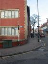
B5214
| B5214 | ||||
| Location Map ( geo) | ||||
| ||||
| From: | Urmston (SJ766944) | |||
| To: | Trafford Park (SJ784969) | |||
| Distance: | 3.2 miles (5.1 km) | |||
| Meets: | B5213, B5158, M60, B5211, A576, A5081 | |||
| Former Number(s): | A575, A5081 | |||
| Highway Authorities | ||||
| Traditional Counties | ||||
| Route outline (key) | ||||
| ||||
The B5214 is an urban B-road in Trafford.
The road starts at traffic lights on the B5213 in Urmston and heads north along Station Road, soon crossing the Manchester to Warrington railway line by the station. The road then continues north into Davyhulme, where it crosses the B5158 at a roundabout officially known as Davyhulme Circle, but generally referred to by locals as the Nag's Head. The eponymous large pub stands on the northern side, but it is the presence of parking spaces on the eastern flank and a bus stop on the western that make this a somewhat unusual roundabout to negotiate. Originally the B5214 ended here, with the road ahead being the A575. When that road was bypassed after World War II the B5214 was extended north to meet the new line of the A575 (now the B5211) at Dumplington Circle (now Ellesmere Circle) and was later extended further along Ashburton Road West, previously the A5081, when that number was used for the new Park Way linking to the motorway at Lostock Circle.
The current line of the B5214, therefore, passes the Trafford Retail Park and reaches the M60 at junction 10, which is still known to older locals as Cascade after a large car dealership on the site of the current retail park. The next section is dual-carriageway as the B5214 passes the Trafford Centre before it crosses the B5211 at a roundabout and becomes S2 once more. After crossing the Bridgewater Canal the road turns easterly and zigzags through Trafford Park before ending at a roundabout where it meets the A576 and A5081.


