B891
| B891 | ||||
| Location Map ( geo) | ||||
| ||||
| From: | near Creagorry (Creag Ghoraidh) (NF798493) | |||
| To: | Peters Port (Port Pheadair) (NF849457) | |||
| Distance: | 4.1 miles (6.6 km) | |||
| Meets: | A865, Pier | |||
| Highway Authorities | ||||
| Traditional Counties | ||||
| Route outline (key) | ||||
| ||||
For the former B891 on North Uist, see B891 (North Uist).
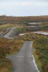
The B891 is a good old-fashioned road to nowhere, which runs along the southern shore of the Isle of Benbecula.
Route
The road starts to the north of Creagorry (Creag Ghoraidh) on the A865, and heads east into the townships of Hacklet (Haclait), where a staggered crossroads provides a link back to the South Ford Causeway, while the left turn is a long meandering dead end through Creagastrom. A short causeway then leads the road onto Grimsay (Griomasaigh), one of the larger rocky isles which lie off of Benbecula's east coast. There are a scattering of houses on the roadside at the western end of the island, but the road continues, crossing a bridge to a tidal rock, from where a series of causeways link uninhabited rocky islands together. The last causeway crosses onto Eilean na Cille where the road terminates at a pier, over a mile after the last house. This is not just any old pier, mind: this one was built by the Government in 1894 for the Steamers and to help the fishing community. Unfortunately, the Government in their wisdom forgot to make sure that the pier was accessible by fishing boats, and for 10 years they also forgot to build the causeways and road to get to it. What use is a pier on a rocky islet, with no land or sea access?
Google Earth are now showing this road as unclassified, and while that would be a sensible option, it is almost certainly an error.
History
The 1922 Road Lists confirm that Benbecula didn't have any classified roads at all to begin with. However, as the A865 was created as a Lochmaddy - Daliburgh spine road within a couple of years the numbers it displaced seem to have been re-allocated to Benbecula. The road itself was apparently, eventually built by Inverness-shire County Council in 1906/7. Trials were held with Steamer visits a few years later, but proved unsuccessful due to the navigation difficulties in the approach, and it is only in recent years that the old wooden pier has been replaced by a concrete slip, which has resulted in some use by fishing boats.


