B861
| B861 | |||||||
| Location Map ( geo) | |||||||
| |||||||
| From: | Inverness (NH663450) | ||||||
| To: | Tombreck (NH689348) | ||||||
| Distance: | 7.5 miles (12.1 km) | ||||||
| Meets: | A82, B862, B853, B8082, B851 | ||||||
| Old route now: | B9161, A9 | ||||||
| Primary Destinations | |||||||
| Highway Authorities | |||||||
| Traditional Counties | |||||||
| Route outline (key) | |||||||
| |||||||
Route
The B861 is the only one of the original B86x roads still in situ, although even here the road no longer follows any of its 1922 route, going south of Inverness rather than north.
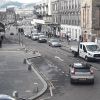
The road starts on the A82 in Inverness and initially follows the old route of the A9 into the city centre. This takes it over the Ness Bridge and along Bridge Street before it turns sharp right as it reaches the pedestrianised High Street (where the A9 went ahead). Climbing up Castle Street, the route passes the end of the B853 and then follows Culduthel Road as it weaves through the suburbs of Inverness. After a couple of miles, Culduthel Road and the B861 TOTSO to the right, the road ahead being the unclassified Slackbuie Avenue. Both routes reach the A8082 at roundabouts, the B861 at Leys Roundabout next to Inverness Royal Academy. Continuing ahead, the B861 soon reaches an unsigned TOTSO where it turns right, the left turn being the much more recent Slackbuie Distributor Road which in many ways is a quicker and more direct way of following the B861 route.
Soon after the junction, the B861 narrows to single-track where someone thoughtlessly built a couple of bungalows 30 or more years ago. As it leaves Inverness behind, climbing steadily over Drummossie Muir, the road never really regains a full S2 width, often narrowing to single-track, albeit with hard and frequently used verges which permit two cars to pass at a reasonable speed. The route climbs to a height of 250m, higher than the A9 to the east, but slightly lower than General Wade's military road between the two. After a relatively level section across the summit, the road starts a gentle descent to the River Nairn, which is reached after a couple of sharp bends, and crossed by Balnafoich Bridge. Soon after, the B861 terminates on the B851 in the small, scattered village of Tombreck.
History
Before the A9 was extended north in 1935, all roads to the north of Inverness were in the 8 zone. As a result, the B861 originally started at Munlochy on the A833 (now A832) and used the Kessock Ferry to reach Inverness. It then followed Kessock Road, Lower Kessock Street and Grant Street to cross the River Ness on Waterloo Bridge. The final run into the city centre was probably along Chapel Street and Academy Street, although the scale of the MOT maps makes it difficult to be certain. Sometime in the mid 1920s, the route was extended southwards, probably at around the same time that the A862 was created, spawning a number of new B roads on the south/eastern side of Loch Ness. This included all of its current route south of the High Street.
The original part of the route was renumbered B9161 in 1935, when the old A88 became the A9, with the B861 surviving from Inverness High Street southwards. Then, when the Kessock Bridge was opened, some of the B861's original route on the north of the Beauly Firth became a heavily upgraded A9, whereas the section to the south was eventually renumbered or declassified.


