B898
| B898 | ||||||||||
| Location Map ( geo) | ||||||||||
| ||||||||||
| From: | Dunkeld (North) (NO003436) | |||||||||
| To: | Grandtully (NN924532) | |||||||||
| Distance: | 9 miles (14.5 km) | |||||||||
| Meets: | A9, A827 | |||||||||
| Old route now: | A9, A827 | |||||||||
| Highway Authorities | ||||||||||
| Traditional Counties | ||||||||||
| Route outline (key) | ||||||||||
| ||||||||||
For the former B898 at Tarbert, Harris, see B898 (Harris).
The B898 runs along the south western side of Strathtay, linking up the small villages and hamlets on the opposite side of the river to the A827 and A9.
Route

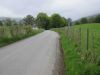
It starts a few miles north of Dunkeld, just before the A9 crosses the River Tay to rejoin the old alignment a few miles further north again. Heading north, the road is followed by the Perth - Inverness railway line to the east, and to the west is Craigvinean Forest, part of the Tay Forest Park. There are a number of scattered properties before the first real village of Dalguise is reached, and the railway line sweeps eastwards across the river. More scattered houses are passed, including some rather grand Victorian edifices before the small village of Balmacneil is passed. All of the way, the road is essentially S2, albeit without a centre line and occasionally narrowing to single-track.
As the River Tay slowly turns to the west, the road follows suit, with the river often in sight at the bottom of the hill. Another railway bridge is seen crossing the river, although this time for the long abandoned Aberfeldy Branch Line. Between Balnamuir and Balnaguard the embankment for the old branch is often close to the road, and so blocks the view across the river. After a brief break, the embankment returns, now covered in trees, before the road makes a quick dogleg across the old alignment and regains the river bank. It is now just a mile or so to the roads end, at a TOTSO junction with the A827 next to the Pitnacree Bridge across the Tay.
History
The whole of the B898 was originally unclassified; the B898 number was originally used on Harris but had been moved south to Perthshire by 1932. At that time the road started on the A822 in Little Dunkeld and ran upstream to join its present route to Grandtully, where it ended on the A827 in the centre of the village.
In more recent years the B898 has been truncated at both ends. The southernmost couple of miles into Dunkeld have been obliterated by the A9 bypass, whilst the A827 has taken over the B898's northernmost mile to allow it to bypass Strathtay.