B822
| B822 | ||||||||||
| Location Map ( geo) | ||||||||||
| ||||||||||
| From: | Torrance (NS618736) | |||||||||
| To: | Callander (S) (NN636052) | |||||||||
| Distance: | 26.5 miles (42.6 km) | |||||||||
| Meets: | A807, A891, B818, B8037, A811, B8031, A873, B8032, A81 | |||||||||
| Highway Authorities | ||||||||||
| Traditional Counties | ||||||||||
| Route outline (key) | ||||||||||
| ||||||||||
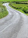
The B822 is a perhaps the longest Class II road in Scotland's central belt, and one that covers a dramatic route, as it climbs over the Campsie Fells before passing through the Trossachs. Unusually, however, it doesn't appear to have had any substantial changes to its route in the last century.
Route
Torrance - Fintry
The route starts at the Kelvinbridge Roundabout on the A807 on the southern edge of Torrance and heads north along Main Street through the village. The road TOTSOs right at traffic lights and leaves town along Campsie Road, which winds northeast, then north, across the rolling fields. Soon a steep, ominous-looking escarpment (the edge of the Campsie Fells) becomes visible ahead. The road descends to cross the Glazert Water and enters Lennoxtown, where it reaches a T-junction on the A891 (former B821). There is then a multiplex west along Main Street for over half a mile before the B822 regains its number by turning right.
The road heads north out of town on the aptly named Crosshill Street, then Crow Road, passing the golf course and drawing ever closer to the escarpment mentioned above. After a few wiggly bends, the road makes a final left turn and climbs steadily across the flank of the hill, with excellent views to the left and the steep hill rising to the right. Although never particularly straight, or wide, forward visibility is generally good allowing decent progress when the road is clear. Eventually, the road reaches the steep valley of Campsie Glen and bends to the right to follow it upstream into the hills. There is a car park here, offering a fantastic viewpoint south across the rolling hills. The road continues north into the upper reaches of the valley, the tumbling stream down to the left. Before long, however, the valley peters out into a mountain pass over the moors.
The Burn is crossed at Alnwick Bridge, beyond which a small parking area sits next to some pools in the burn. The road continues to wind gently up hill to the watershed, between gently sloping green hills , with a forestry plantation off to the right. The summit height of 337 metres (well over 1000 feet) is reached just before the new houses at Muir Toll, after which the road begins to descend again. As may be expected, the descent is not as protracted, nor as dramatic as the climb. The moor is relatively flat to begin with, and the road follows the contours as it turns away from the headwaters of the River Carron. The gradient then steepens a little as the road heads north along a couple of straighter sections. This leads to the narrow bridge over the Clachie Burn, after which the road becomes much twistier for a while, although the gradient hardly changes.
The road then turns north westwards to wind down above the Tochan Burn, eventually descending a ridge between two streams into the valley of the Endrick Water. The Gonathan Burn is crossed at a narrow bridge, after which the B818 comes in from the right. There is then a multiplex west for over a mile to Fintry. While it might be expected that the B818 should be the dominant number this is not in fact the case.
Fintry - Callander
The B822 TOTSOs right at a triangular junction in Fintry to conclude the multiplex. The Endrick Water is then crossed on Fintry Bridge before the road leaves the popular tourist destination behind. There is now another steep escarpment to the right (the Fintry Hills) but this time the road goes round the bottom rather than attempting to climb them. Nevertheless, after a slight climb away from the Enrick Valley, there is quite a noticeable climb up from the bridge over the Lernock Burn to the summit of Kippen Muir at 184m. The road continues north east across Kippen Muir, now to the north of the Fintry Hills, and descends gently into the pretty village of Kippen, with its wide tree lined main street. In the centre of the village the B8037 turns off to the left, beyond which the road descends steeply down a narrow twisty hill into the expansive valley of the River Forth.
The B822 crosses the A811 at Kippen Station Roundabout to head out across Flanders Moss. After zigzagging round the former Kippen Station site, it crosses the Forth at the Bridge of Frew before following the river downstream for one meander. It then bends sharply left at Frew Toll, its junction with the B8031. The road continues north along a few dead-straight sections interspersed with sharp corners across completely flat land to reach the small town of Thornhill, which lies on the northern fringe of the flood plain. It climbs Kippen Road to reach the A873 at a crossroads opposite the masonic lodge. There is a short multiplex north before the B822 turns right, as the A873 swings westwards, to continue north.
The road undulates for a short distance before beginning to climb once again. It climbs up to Torrie Forrest on Lennieston Muir which it skirts, before entering. When heading south, there are some fine views from the road across the Forth Valley, but nowhere safe to stop and enjoy them. From the summit at 138m, the road gently descends a series of sinuous bends into the valley of the River Teith, narrowing for no apparent reason. Presently the B8032 comes in from the right, after which the B822 ends at a T-junction on the A81 about a mile and a half south of Callander.


