B4427
| B4427 | |||||||||||||||||||||||||
| Location Map ( geo) | |||||||||||||||||||||||||
| |||||||||||||||||||||||||
| From: | Rudgeway (ST626867) | ||||||||||||||||||||||||
| To: | Hambrook (ST641789) | ||||||||||||||||||||||||
| Via: | Frogland Cross | ||||||||||||||||||||||||
| Distance: | 6.1 miles (9.8 km) | ||||||||||||||||||||||||
| Meets: | A38, B4059, B4057, B4058 | ||||||||||||||||||||||||
| Old route now: | A4017, A4175 | ||||||||||||||||||||||||
| Highway Authorities | |||||||||||||||||||||||||
| Traditional Counties | |||||||||||||||||||||||||
| Route outline (key) | |||||||||||||||||||||||||
| |||||||||||||||||||||||||
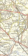
The B4427 is a semi-rural B-road to the north of Bristol.
The route starts on the A38 at Rudgeway and initially heads east to Earthcott Green, where the onward road is the B4059. Our road turns south here heading for Bristol, or at least its distant northern suburbs. We dive over the M4 and follow it, almost getting lost on the edge of Great Stoke, and briefly multiplexing with the B4057. It's not long before we cross the M32 and terminate on the B4058 at Hambrook, just north of the notorious Hambrook Lights on the A4174.
History
The B4427 was an early addition to the classified road network, being upgraded from an unclassified road in the mid-1920s. At this time it was longer and in the intervening years the road has been lengthened and then shortened again.
Originally the B4427 ran from the A38 in Rudgeway along its present route via Hambrook to end on the A432 in Downend. In 1935 it was extended to Keynsham along three separate previously existing Class II roads and three A-road multiplexes. From Downend the A4017 was followed into Staple Hill, then the B4427 took over the B4047 to Warmley then multiplexed along the A420 into Bridgeyate. A southerly run along the ex-B4426 took us to the A431 in Bitton, after which we followed the former B4045 into Keynsham.
The southern extension lasted for some years; however, this section was later upgraded to become the A4175. With the completion of the eastern arm of the A4174 Avon Ring Road, some of the route has now been downgraded once more – to a cycle path! The middle section, from Hambrook to Downend, is now part of the A4017, although for a time it was a spur of the A4174.


