B1294
| B1294 | |||||||
| Location Map ( geo) | |||||||
| |||||||
| From: | Park Road, Sunderland (NZ399563) | ||||||
| To: | Sans Street, Sunderland (NZ401569) | ||||||
| Via: | Toward Road, Borough Road | ||||||
| Distance: | 0.5 miles (0.7 km) | ||||||
| Meets: | A1231, A1018 | ||||||
| Former Number(s): | A1018, A19 | ||||||
| Primary Destinations | |||||||
| Highway Authorities | |||||||
| Traditional Counties | |||||||
| Route outline (key) | |||||||
| |||||||
The B1294 is a short link road in Sunderland city centre.
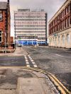
It starts at a traffic light controlled crossroads on the A1231, Park Road / Peel Street, and runs north along Toward Road, forming the eastern edge of Mowbray Park. It then reaches another traffic light controlled junction and turns right along Borough Road, which it follows to end on a roundabout on the A1018, Sans Street.
History
Although only short, the route of the B1294 has been modified numerous times, mainly due to its proximity to a major through route.
In 1922 the B1294 started at the western end of Borough Road on what was then the A19, Burdon Road / Fawcett Street, by Sunderland Museum. At its eastern end it did not follow the full length of Borough Road but forked to the south along Hudson Road, Lawrence Street, and Moor Terrace to end at the eastern end of the latter road in the docks area. Although this route is shown in all One Inch mapping from at least 1947 onwards, the 1:25,000 map appears to show the B1294 instead reaching Moor Terrace via the remainder of Borough Road and Cousin Street. It is not clear whether this reflects an older routing or a mapping error.
By 1965, the A19 had begun to use John Street, parallel to Fawcett Street, in a one-way system - in the process taking over the short section of Borough Road between the two. By 1972 the one-way system had been extended onto Toward Road and Park Road, and the western end of the B1294 was re-routed to begin at the junction of Fawcett Street and Athenaeum Street, following Athenaeum Street east as far as Frederick Street then turning south to resume its original course along Borough Road.
The route of the B1294 was further modified when through traffic on the former A19, now numbered A1018, was diverted away from Fawcett Street onto a new inner ring road along Sans Street and West Wear Street. Borough Road was used to connect the new route to the old, meaning the B1294 was truncated to begin at the junction of Borough Road and Sans Street. From here a new, curving section of road carried it back to its original route at Lawrence Street, leaving Hudson Street unclassified. This is the version of the route listed in the DfT Card Index from c2002, which shows the B1294 number applying to only Lawrence Street and Moor Terrace.
In 2008, the A1018 was moved from Borough Road and Toward Road onto a more easterly alignment, to join up with the new Southern Radial Route. In the process, it took over part of the B1294 on the curve between Sans Street and Lawrence Street. Lawrence Street and Moor Terrace were declassified, and the B1294 was moved onto the A1018's former alignment. The entirety of the present B1294 was thus earlier part of the A1018; as of 2017 some green signs remain in place, including one displaying the A1018 number.

