A5067
| A5067 | |||||||||||||
| Location Map ( geo) | |||||||||||||
| |||||||||||||
| From: | Old Trafford (SJ813964) | ||||||||||||
| To: | Chorlton-on-Medlock (SJ840970) | ||||||||||||
| Via: | Hulme | ||||||||||||
| Distance: | 2.2 miles (3.5 km) | ||||||||||||
| Meets: | A56, A5014, A56, A57, A57(M), A5103, A57(M) | ||||||||||||
| Former Number(s): | A56, A6144 | ||||||||||||
| Highway Authorities | |||||||||||||
| Traditional Counties | |||||||||||||
[[Lancashire]|Lancashire]]]] | |||||||||||||
| Route outline (key) | |||||||||||||
| |||||||||||||
The A5067 is an urban A-road to the south of Manchester city centre. However, the exact route of the road is uncertain. Whilst the Ordnance Survey show it (2011) as starting near White City Circle in Old Trafford and running along Stretford Road and Cavendish Street to terminate on the A57(M) near the BBC and the Metropolitan University, they also show a spur along Chorlton Road back to the A56 Chester Road. meeting the A57(M) at its western terminus! This spur is, however, mentioned by number on Manchester City Council paperwork.
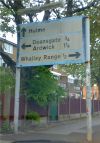
Other mapping does not agree, and only shows the A5067 as being the short section between White City Circle and the A5014 Chester Road - which is borne out by the signage on the route.
History
What is certain is that in 1922, the A5067 ran between the-now A5014 (then A56) Chester Road, pretty much in a straight line along Stretford Road, Cavendish Street and Grosvenor Street, terminating on the A6 at Ardwick Green, just south of today's A635(M). With the expansion of the universities in the area, the defunct section is now only partially passable to traffic, and that section of Grosvenor Street that has not been pedestrianised is now one-way westbound.
Editions of the Manchester A-Z from the late 1980s label the spur as an isolated section of the A6144. This, if correct, would appear to have been in anticipation of construction of a new crossing of the River Mersey near Jackson's Bridge, which would have connected Hardy Lane, the continuation of Mauldeth Road West, with what is now M60 J6, creating a new link between Whalley Range and Sale, presumably all to be given the new number. This has never gone ahead. The date that the isolated A6144 section was renumbered to be the spur of the A5067 is not known, but A-Z mapping from the late 1990s carries the current number.
The Hulme area is particularly well known for residents of Manchester. It was, from 1970 onwards, subject to one of the city's biggest slum clearance schemes. The result was a vast number of system build maisonettes, flats, and homes forming part of the new Hulme district. Until these were built, Stretford Road was a major east-west shopping street, but this was to change in 1972 with the completion of the 'jewel in the crown' of this scheme - Hulme 5, better known as the Hulme Crescents. The construction of this development erased most of Stretford Road entirely - something the opening of the A5103 dual carriageway a year earlier had started. Scholars of the Manchester area know the rest of the story; Hulme was a failure, and by 1998 it had all been demolished and replaced with conventional homes. The opportunity was taken to rebuild Stretford Road, and the completion of the Hulme Arch caused great changes to the A5103 junction but re-established the east-west road link.


