Star.pngStar.pngStar grey.pngStar grey.pngStar grey.png

A5085

From Roader's Digest: The SABRE Wiki
Jump to navigation Jump to search
A5085
Location Map ( geo)
Cameraicon.png View gallery (15)
Blackpool Road
From:  Larches (SD492299)
To:  Ribbleton (SD563301)
Distance:  5.2 miles (8.4 km)
Meets:  A583, A5072, B5411, A6, A6063, B6241, B6243, A59
Former Number(s):  A583
Highway Authorities

Lancashire

Traditional Counties

Lancashire

Route outline (key)
A5085 Link in Preston

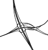
The A5085 was created in the mid-1920s to form a bypass of Preston city centre. It connects the A59 at the Hesketh Arms Roundabout to the A583 at a massive fork junction constructed in the 1960s. Until recently it was signposted as a Ring Road.

For most of the day this road remains horribly congested, despite being bypassed by the M55 in 1974.


Route

The A5085 Blackpool Road

The road starts in the Larches area of town, where the A583 TOTSOs at the fork. However, that road is dual-carriageway whilst the A5085 is single. The road heads east along the residential Blackpool Road. After passing Ashton Park the A5072 turns off to the right at traffic lights; this is the original line of the A583 and so the original western end of the A5085.

Continuing east, there's a short dual section as we cross over the railway line to Blackpool and also the B6241. The central reservation lasts until the next set of traffic lights where we meet the B5411, which provides access to the other B-road. We then cross the Lancaster Canal and the West Coast Main Line before another D2 section leads to traffic lights where we cross the A6.

On the far side of the road we lose the houses and follow a leafy avenue to traffic lights on Sir Tom Finney Way, which is the B6241 (the road forms a large loop) to the left and A6063 to the right. We're residential again as we pass through the suburb of Holme Slack and continue on to Ribbleton. The B6243 is crossed at traffic lights, after which we pass between a park and a cemetery to end at a roundabout on the A59.

History

The A5085 making an early appearance on the 1930-31 MOT Map (Sheet 8)

The Addison Road extension bridges over the railway and canal on the section from Tulketh Brow to Brook Street completed the bypass. It was just awaiting surfacing per a Fleetwood Chronicle Report of 13 June 1924 and had been incomplete at Easter 1924. The upgraded former Serpentine Road from Garstang Road to Deepdale Road and the new road eastwards to A59 New Hall Lane had been open then. Work had started in November 1920 on the 2 mile road. Width was to be 75 feet with a 27 foot carriageway. At the western end the existing Long Lane from Tulketh Road to Tulketh Brow was used, as was the then Addison Road between Brook Street and Garstang Road. All sections of road were later renamed Blackpool Road.


A5085
Junctions
Related Pictures
View gallery (15)
A5085 Split - Coppermine - 6282.jpgA583 a5085 jct 2006.JPGHPIM3072.JPGHPIM3094.JPGHolme Slack Interchange.png
Other nearby roads
Preston
NCN55 • A6 • A49 • A59 • A582 • A583 • A675 • A5071 • A5072 • A5188 • A6063 • A6063 (Mellor Brook) • B5254 • B5258 (Preston) • B5264 • B5411 • B6230 • B6241 • B6241 (Deepdale Road, Preston) • B6242 • B6243 • Belmont Link Motorway • C225 (Lancashire) • C226 (Lancashire) • C227 (Lancashire) • C228 (Lancashire) • C220 (Lancashire) • C221 (Lancashire) • C223 (Lancashire) • C240 (Lancashire) • C242 (Lancashire) • C243 (Lancashire) • C244 (Lancashire) • C245 (Lancashire) • C246 (Lancashire) • C247 (Lancashire) • C250 (Lancashire) • C251 (Lancashire) • C252 (Lancashire) • C254 (Lancashire) • C255 (Lancashire) • C256 (Lancashire) • C281 (Lancashire) • C328 (Lancashire) • C329 (Lancashire) • C330 (Lancashire) • C331 (Lancashire) • C332 (Lancashire) • C333 (Lancashire) • C334 (Lancashire) • C335 (Lancashire) • C336 (Lancashire) • C337 (Lancashire) • C338 (Lancashire) • C340 (Lancashire) • C344 (Lancashire) • C345 (Lancashire) • C346 (Lancashire) • C347 (Lancashire) • C348 (Lancashire) • C349 (Lancashire) • C350 (Lancashire) • C351 (Lancashire) • C352 (Lancashire) • C353 (Lancashire) • C354 (Lancashire) • C355 (Lancashire) • C356 (Lancashire) • C357 (Lancashire) • C358 (Lancashire) • E05 • E33 (London - Glasgow) • Eastern Primary (Preston) • M6 • M55 • M58 (Preston) • M59 • M61 • M65 • T12 (Britain) • T13 (Britain) • T20 (Britain) • T67 (Britain) • Walton Summit Motorway
A5000–A5099
A5000 • A5001 • A5002 • A5003 • A5004 • A5005 • A5006 • A5007 • A5008 • A5009 • A5010 • A5011 • A5012 • A5013 • A5014 • A5015 • A5016 • A5017 • A5018 • A5019
A5020 • A5021 • A5022 • A5023 • A5024 • A5025 • A5026 • A5027 • A5028(S) • A5028(N) • A5029 • A5030 • A5031 • A5032 • A5033 • A5034 • A5035 • A5036 • A5037 • A5038 • A5039
A5040 • A5041 • A5042 • A5043 • A5044 • A5045 • A5046 • A5047 • A5048 • A5049 • A5050 • A5051 • A5052 • A5053 • A5054 • A5055 • A5056 • A5057 • A5058 • A5059
A5060 • A5061 • A5062 • A5063 • A5064 • A5065 • A5066 • A5067 • A5068 • A5069 • A5070 • A5071 • A5072 • A5073 • A5074 • A5075 • A5076 • A5077 • A5078 • A5079
A5080 • A5081 • A5082 • A5083 • A5084 • A5085 • A5086 • A5087 • A5088 • A5089 • A5090 • A5091 • A5092 • A5093 • A5094 • A5095 • A5096 • A5097 • A5098 • A5099
Former uses: A5002 • A5004 • A5012 • A5013 • A5014 • A5017 • A5035 • A5064 • A5065 • A5068 • A5070 • A5076 • A5080 • A5088 • A5092 • A5093


SABRE - The Society for All British and Irish Road Enthusiasts
Discuss - Digest - Discover - Help