B1074
| B1074 | ||||||||||
| Location Map ( geo) | ||||||||||
| ||||||||||
| From: | Lowestoft (TM545938) | |||||||||
| To: | St Olaves (TM459993) | |||||||||
| Distance: | 8 miles (12.9 km) | |||||||||
| Meets: | A1144, A1117, B1375, A143 | |||||||||
| Primary Destinations | ||||||||||
| Highway Authorities | ||||||||||
| Traditional Counties | ||||||||||
| Route outline (key) | ||||||||||
| ||||||||||
For the original B1074 near Ipswich, see B1074 (Copdock - Gt Blakenham).
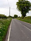
The B1074 is a semi-rural B-road in northeast Suffolk. The road was originally unclassified but gained its number in the mid-1920s, making it an early example of a recycled number.
The road starts at traffic lights on the A1144 on the edge of Lowestoft town centre. It heads west, initially along Church Road, crossing a dismantled railway line and continuing into Normanston, where it reaches the A1117 at a roundabout. There's then a multiplex to the right before the B1074 regains its number at traffic lights. Prior to the construction of the A1117 the B1074 followed the parallel Oulton Road; this has now been closed to through traffic.
The road continues west along Somerleyton Road (its original route was along Oulton Road North) into Oulton, where it crosses a roundabout on the B1375, marking the road's original eastern end (although it had been extended east into Lowestoft by 1932). A short distance further on it reaches open country and bends sharply right to pass between two ponds and enter Blundeston, where there's a sharp left-hand bend.
The road continues west, skirting Somerleyton Park and passing through Somerleyton village. A few more bends take the road into the scattered settlement of Herringfleet, after which a dead-straight wooded section takes the road into St Olaves. We end here, at a T-junction on the A143.


