B7 (Andreas - Jurby)
Jump to navigation
Jump to search
| B7 | ||||
| Location Map ( geo) | ||||
| ||||
| From: | Andreas (SC404991) | |||
| To: | Sartfield, Jurby (SC359993) | |||
| Via: | Jurby East | |||
| Distance: | 2.9 miles (4.7 km) | |||
| Met: | B6, B8, B3 | |||
| Now part of: | B3 | |||
| Traditional Counties | ||||
| Route outline (key) | ||||
| ||||
This article is about the original B7, now the B3.
For the current B7 near Regaby, see B7 (Isle of Man).
For the current B7 near Regaby, see B7 (Isle of Man).
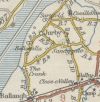
The original B7 ran west from the B6 just to the south of Andreas through Jurby East and onto Sartfield, now part of the modern Jurby village that has grown up around the airfield. The route was renumbered as the B3 before 1963, although it is unclear why, as the B7 number was reused a few miles away at Regaby.
The Manx Government Circular 1131 of 25/02/1926 defines this route as: School near Jurby West to junction of Sulby Bridge Andreas-road
| B7 (Andreas - Jurby) | ||||
| ||||
| ||||
|

