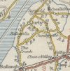
B9 (Jurby West - Ballacain)
Jump to navigation
Jump to search
| B9 | ||||
| Location Map ( geo) | ||||
| ||||
| From: | Jurby West (SC354983) | |||
| To: | Ballacain (SC364974) | |||
| Distance: | 0.9 miles (1.4 km) | |||
| Met: | B3, B4 | |||
| Now part of: | B5 | |||
| Traditional Counties | ||||
| Route outline (key) | ||||
| ||||
The original B9 connected the B4 (now the A13) to the B3, now the A10 at West Jurby, latterly passing along the southern side of Jurby Airfield. It was renumbered before 1963 as the B5, with the B9 number re-used a couple of miles to the south.
The Manx Government Circular 1131 of 25/02/1926 defines this route as: Ballavarran-road-Church to Loughmolla-road
| B9 (Jurby West - Ballacain) | ||
| ||
|
